


HeliPlates app for iPhone and iPad
Developer: California Department of Transportation
First release : 01 Sep 2017
App size: 647 Kb
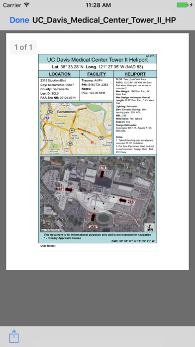
Caltrans has developed informational dataplates, or "HeliPlates," that provide permitted approach paths and other information for all the permitted Hospital Heliports in California. We hope this information will be helpful to emergency planners, helicopter operators, and other users.
The Caltrans HeliPlates app displays a map of Hospital Heliports in California that you can view by Geographic Region or County. You can select a HeliPlate for a specific Hospital Heliport using either the interactive map or by directly choosing the Hospital Name. The HeliPlates include:
- Hospital Name
- Hospital Heliport Geographic “Nav” Coordinates
- Heliport Info and Dimensions
- Hospital Facility and FAA Information
- Regional Map showing the location of the heliport
- Aerial Photo showing the heliport and Permitted Approach Paths
Additionally, HeliPlates can be saved for offline use.